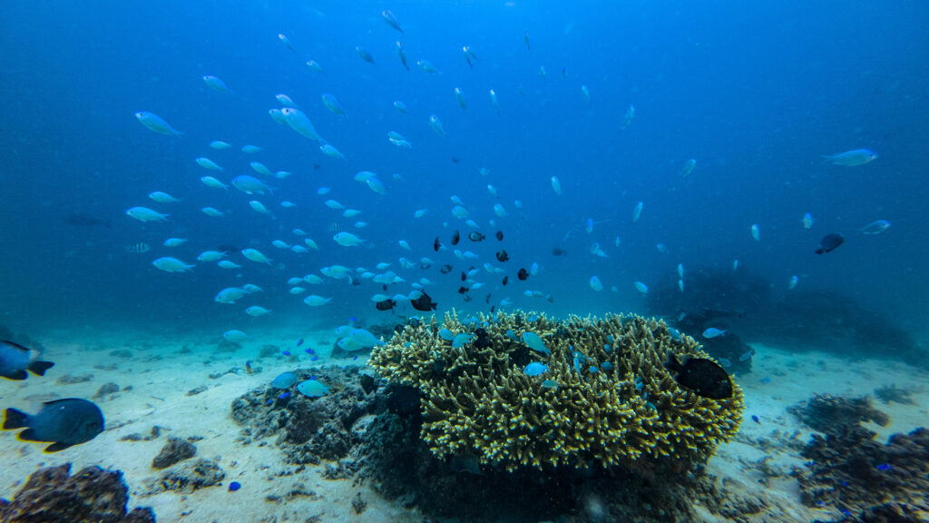
Covering about 18% of the world’s coral reefs, Indonesia is right at the center of the “Coral Triangle” a coral reef area with the highest marine biodiversity in the world. Indonesia’s coral reefs cover 39,583 km2 or about 45.7% of the total 86,503 km2 reef area in the coral triangle region with the highest biodiversity peaks including 590 species of rock corals and 2,200 species of reef fishes. However, it is reported that from a combination of local threats and due to temperature change and bleaching, almost 45% of Indonesia’s coral reefs are under high to very high threat (Huffard et al, 2012). Protection and sustainable management efforts in the coral triangle region, including Indonesia, are a priority in order to maintain coastal ecosystems, fish stock availability and food security from the sea.
CORAL REEF
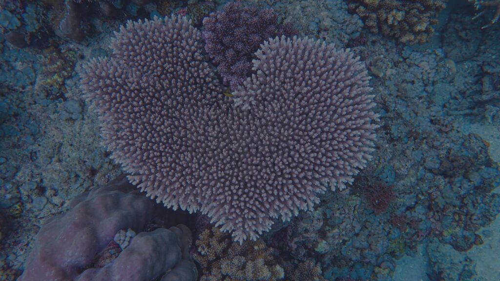
Coral, Also called stony coral, these are animals from the Order Scleractinia, which are capable of secreting CaCO3 (limestone). Single coral animals are generally called polyps.
Reef, Massive limestone deposits, primarily calcium carbonate (CaCO3), which are mainly produced by coral animals and other biota that secrete lime, such as calcareous algae and mollusks. Please provide the text you would like to have translated. The construction of biogenic limestone that forms the basic structure of a coastal ecosystem. Influenced by biological and geological processes.
Reef Corals
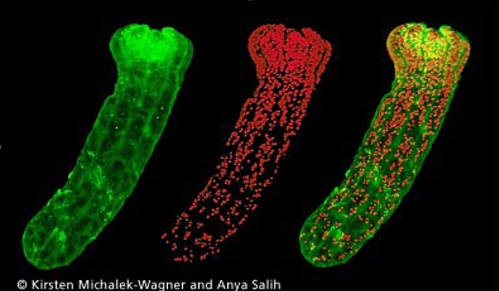
Hermatypic coral, which is coral capable of building reefs, is a reef-building coral, has the symbiotic algae “zooxanthellae” that live within the gastrodermal cells, The relationship between corals and zooxanthellae is mutualistic. Colors of zooxanthellae: green, yellow, red
CORAL REEF MONITORING
Definition
Coral reef health monitoring is defined as the activity of collecting data and information on the bio-ecology of biota groups that are determined as indicators of coral reef health as well as data onsocio-economic changes in coastal communities as beneficiaries of resource utilization and management as well as efforts to conserve and rehabilitate coral reef ecosystems. Good monitoring is based on a regularity of repetition and is carried out in a time series and an increase in the area represented. Changes in time series and spatial extent measured during monitoring will provide important data and information on changes in populations of indicator biota in coastal and small island ecosystems as a measure of the success of intervention in a resource management and protection program, including coral reefs and other related ecosystems.
Why Monitoring?
For targeted management.
Measure the effectiveness of a management plan.
To identify ecosystem changes in a certain area.
Some considerations to note
What information do you want to get? Is it general or specific?
What do you want to monitor?
What resources do you have?
What is the desired scale of monitoring?
What type of reef will be monitored?
What methods should be used?
How much frequency of monitoring needs to be done?
How much operational cost is required?
Is there a need for training and capacity building of surveyors?
How will the data be processed and the observations interpreted?
Is there a need to involve the community?
Good planning will result in monitoring activities that are very useful for coastal resource management.
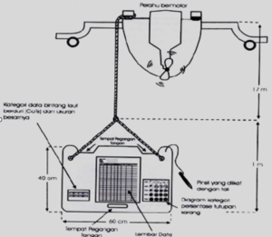
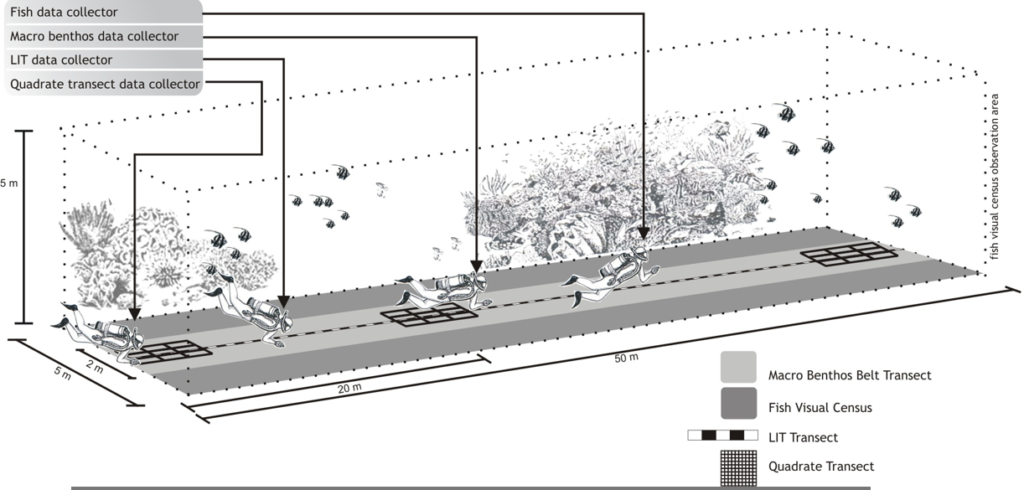
Coral Reef Monitoring Methods
Broad scale method
1. Manta Tow (Manta Survey)
2. Timed Swim (Snorkel Survey)
Medium scale method
1. Point Intercept Transect
2. Line Intercept Transect
Fine scale method
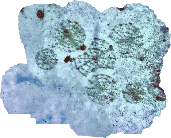
1. Quadrat Transect
2. Belt Transect
Photogrammetry (3D Modeling)
One technology that makes it possible to obtain measurements from photographs is called photogrammetry. This is frequently used with 3D reconstruction, which recreates the objects in a set of images into both 2D and 3D outputs. High-quality data from photogrammetry outputs, including 3D models, point clouds, digital elevation model (DEM) imagery, and orthomosaic imagery, can be gathered with the reconstructions. Numerous industries, including the geospatial sciences, archeology, cultural heritage surveying, agriculture, urban development, video game content creation, visual effects for motion pictures, and underwater habitat surveying, can benefit greatly from these outputs.